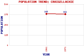
Craigellachie Classification and Statistics Settlement Type: village Population (1971): 382 (1961): 385 Tourist Rating: Text of Entry Updated: 05-JUL-2007 Location Latitude: 57.4896°N Longitude: 3.186°W National Grid Reference: NJ 290 450 A range of modern and historical maps are accessible through the map tab on the right of this page Get directions by entering the UK postcode of your location, home or hotel here eg. EH1 3YT Use the tabs on the right of this page to see other parts of this entry Related Entries There are 29 related entries. (4 Attractions, 1 Council Area, 1 Historical County, 1 Family, 13 Features, 1 Parish, 2 People and 6 Settlements) Names that are not linked do not currently contain any information. Attractions: Craigellachie Bridge Macallan Distillery Speyside Cooperage Visitor Centre, The Speyside Way Council Area: Moray Families: Grant Features: Arndilly House Ben Aigan Blue Hill Broomhill Railway Station Buchromb, Hill of Buchromb, Knock of East Elchies House Fiddich, River Keith Railway Station Knockan Machattie's Cairn Spey, River Strathspey Historical Counties: Moray Parishes: Rothes People: William Marshall Thomas Telford Settlements: Aberlour Archiestown Carron Dandaleith Easter Elchies Rothes
There are 29 related entries. (4 Attractions, 1 Council Area, 1 Historical County, 1 Family, 13 Features, 1 Parish, 2 People and 6 Settlements)
Names that are not linked do not currently contain any information.
By using our site you agree to accept cookies, which help us serve you better